Research Theme 4——Urban Computing: Human Mobility and Land Use
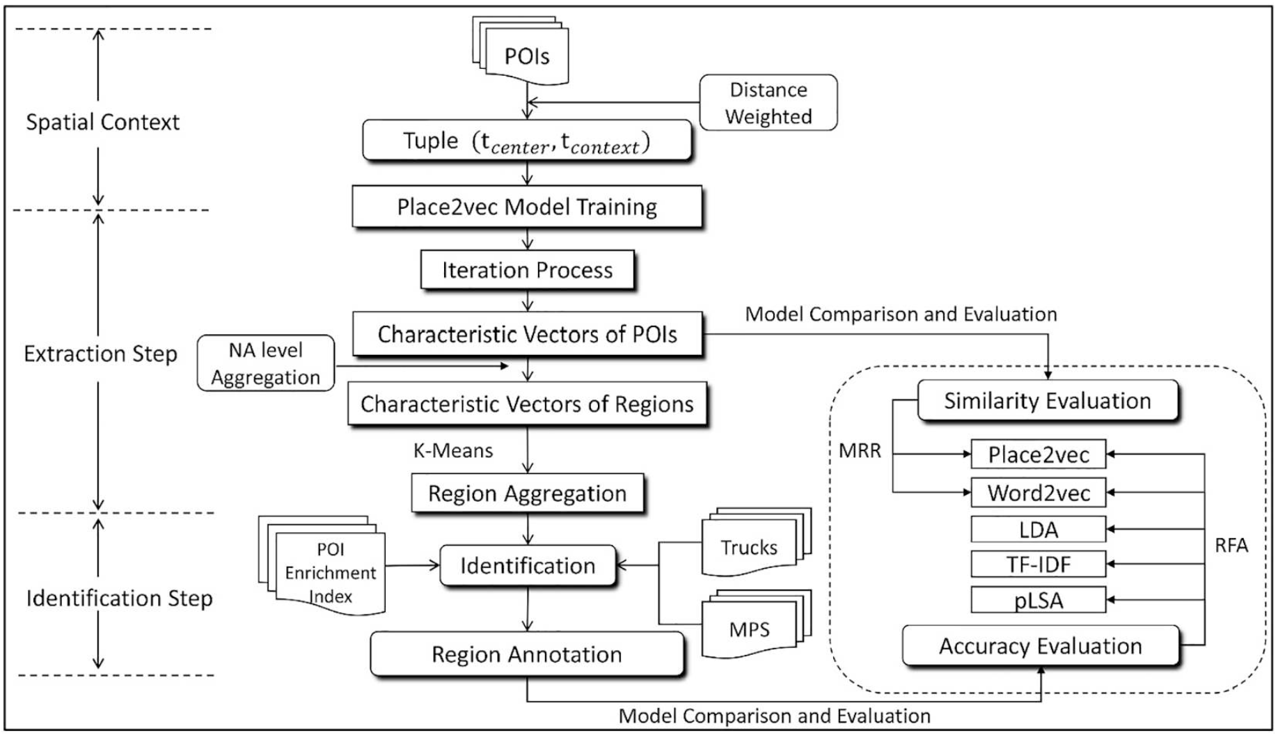
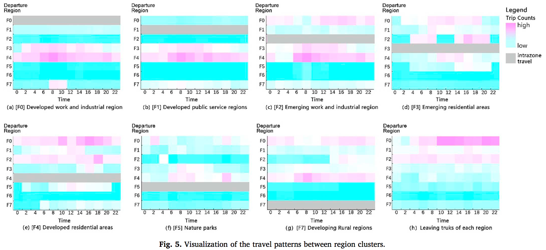
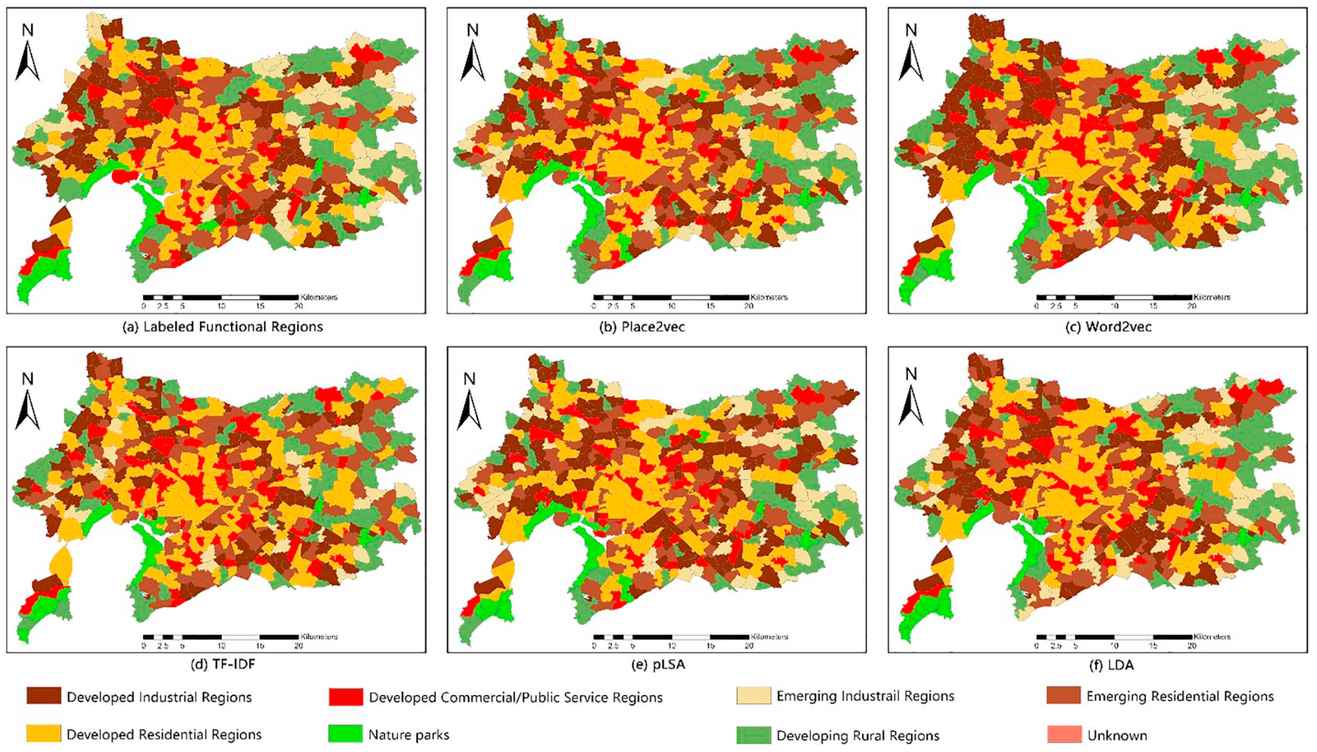
- The actual functions of a region may not reflect the intent of the original zoning scheme from planners. To identify the actual urban functional regions, numerous methods have been proposed with computational advancement. Specifically, remote sensing by image recognition, geodemographic classification, social sensing with big data and geo-text mining techniques have been widely applied. Points-of-interest (POIs) are one of the most common open-access data type used to extract information pertaining to functional zones. However, previous works have either lost sight or did not make full use of the spatial interactions that can be extracted from POIs due to model limitations in the context of geographical space. In this research, we introduced an approach that detects functional regions at the scale of a neighborhood area (NA) by combining POI data and a simplified Place2vec model, which is theorized from the first law of geography.
- Keywords: Urban Functional Regions; Place2vec; POIs;Geo-Text Mining; Machine Learning
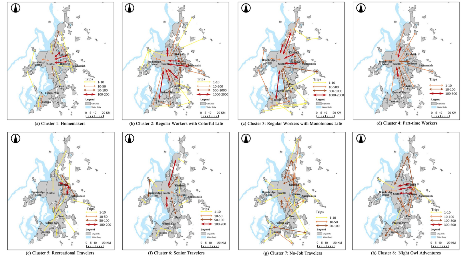
- Paper 2: From edit distance to augmented space-time-weighted edit distance: Detecting and clustering patterns of human activities in Puget Sound region
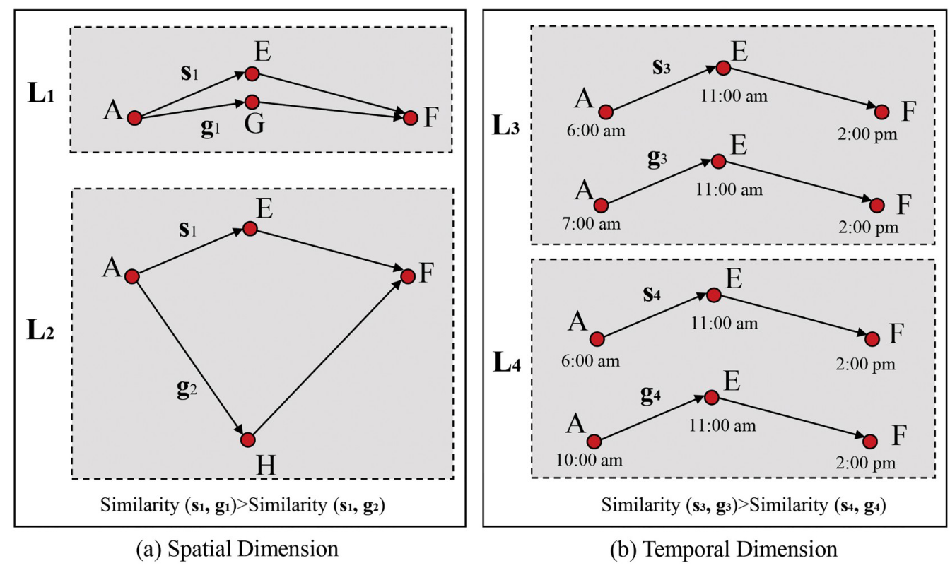
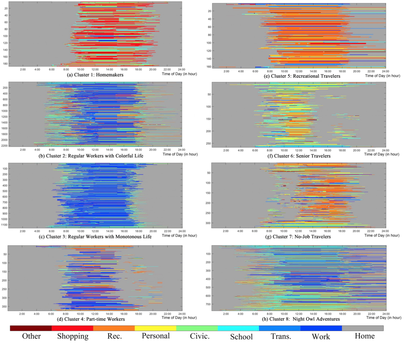
- Considering and measuring the similarity of human activities remains challenging. Existing studies of similarity measures based on traditional edit distance (ED), specifically on activity patterns, do not reflect the spatiotemporal characteristics in the measurement model. Additionally, interdependence between activities is ignored in existing multidimensional sequence alignment methods. To address the gap, we initially extend the traditional edit distance to a space-time-weighted edit distance (STW-ED). Specifically, differences in distance and time between activities are considered cost functions in the operation cost calculation (insertion, deletion, and substitution). We advance STW-ED to an augmented space-time-weighted edit distance method (ASTW-ED)that integrates an optimum-trajectory-based multidimensional sequence alignment method (OT-MDSAM)with STW-ED, treating the nonspatiotemporal dimensions as augment factors. In addition, ontology is considered for the similarity measure for nonspatiotemporal dimensions.
- Keywords: Augmented space-time-weighted edit distance; Multidimensional activities; Puget sound region
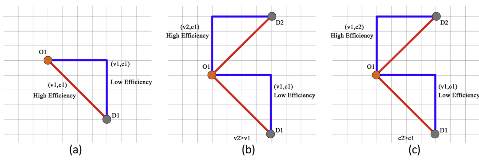
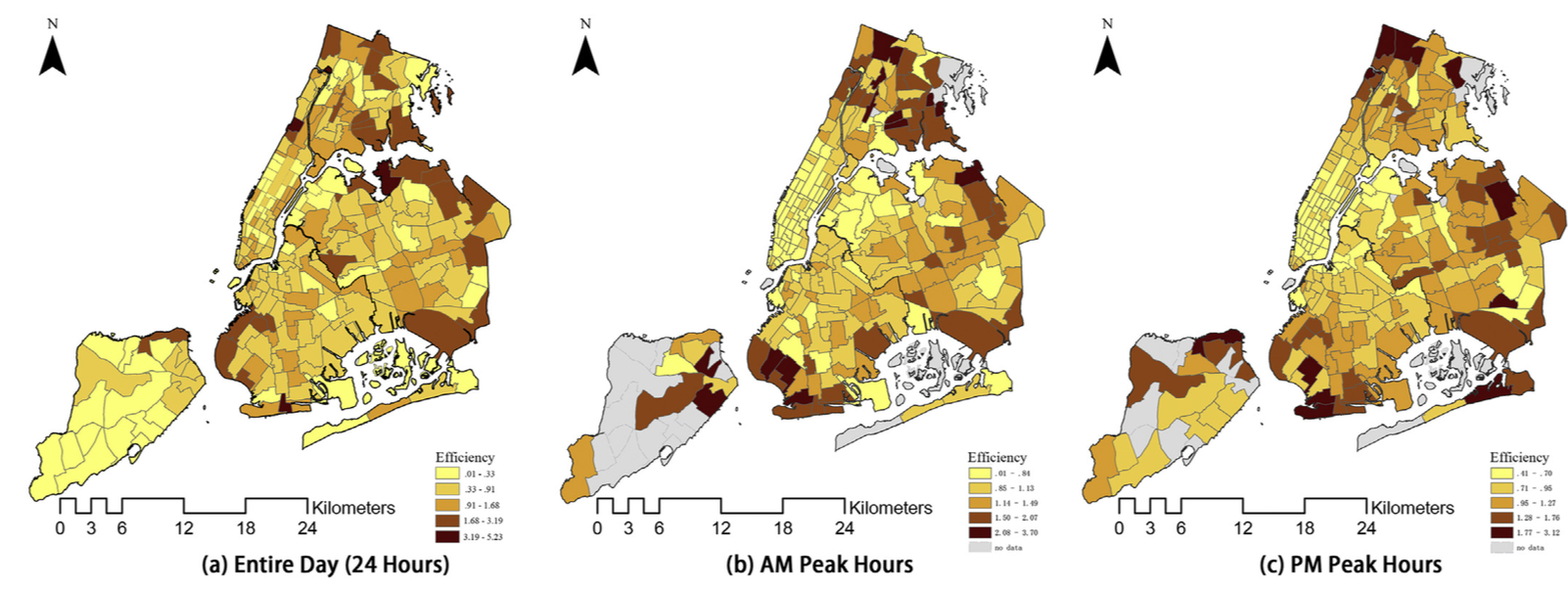
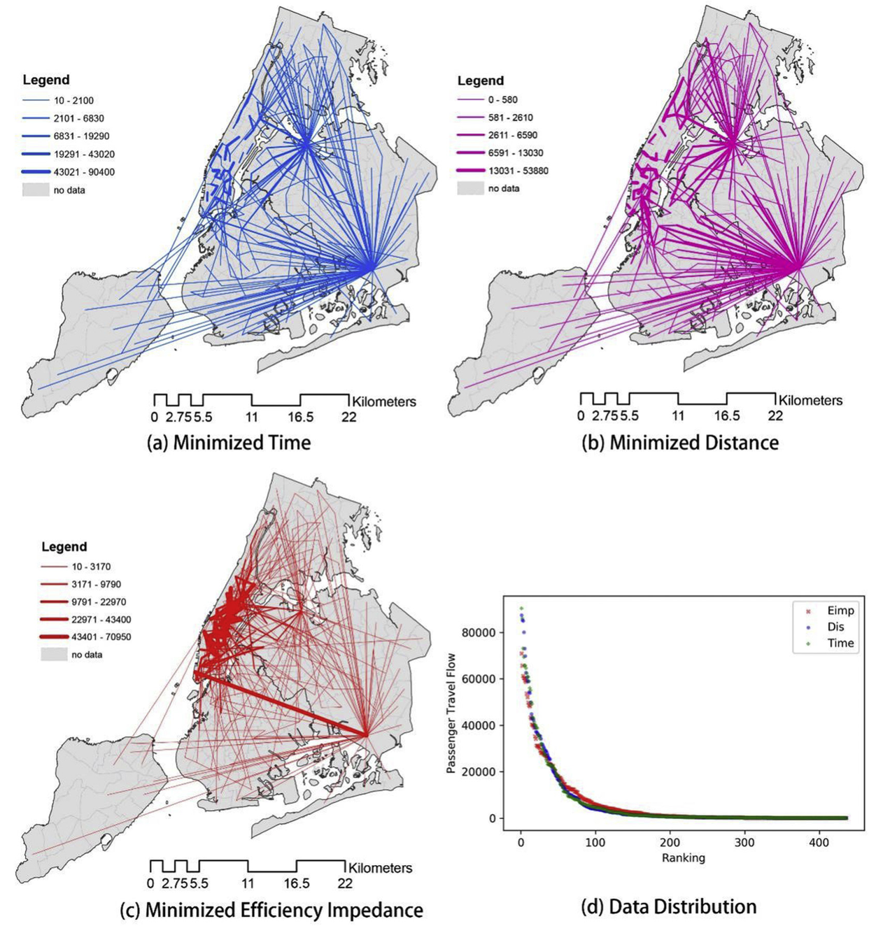
- Paper 3: A bottom-up transportation network efficiency measuring approach: A case study of taxi efficiency in New York City
- In this paper, we proposed an improved transportation network efficiency (TNE) measurement method, which is called passenger- and speed-weighted efficiency (PSWE). The new method is used to measure both origin-destination-level (OD-level) transportation efficiency and citywide transportation efficiency by integrating with the excess commuting (EC) framework. To show the feasibility of the proposed measurement method, we chose New York City (NYC) as the study area and employed open taxi data. By calculating the efficiency value of the OD-level, we discovered that the average distance of highly efficient taxi trips is much longer than that of inefficient trips. Then, the OD-level efficiency value is applied to the EC framework by replacing the conventional cost unit (time or distance) with the proposed efficiency impedance (Eimp). The maps of minimized OD flows indicate that taxi trips within Manhattan and to the two airports (LGA and JFK) should be particularly considered if citywide efficiency is expected to be improved.
- Keywords: Transportation network efficiency; Taxi efficiency; Big data
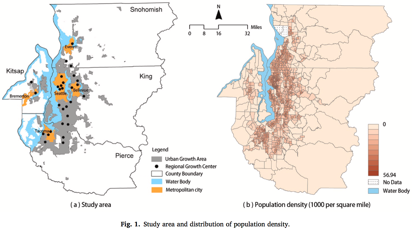
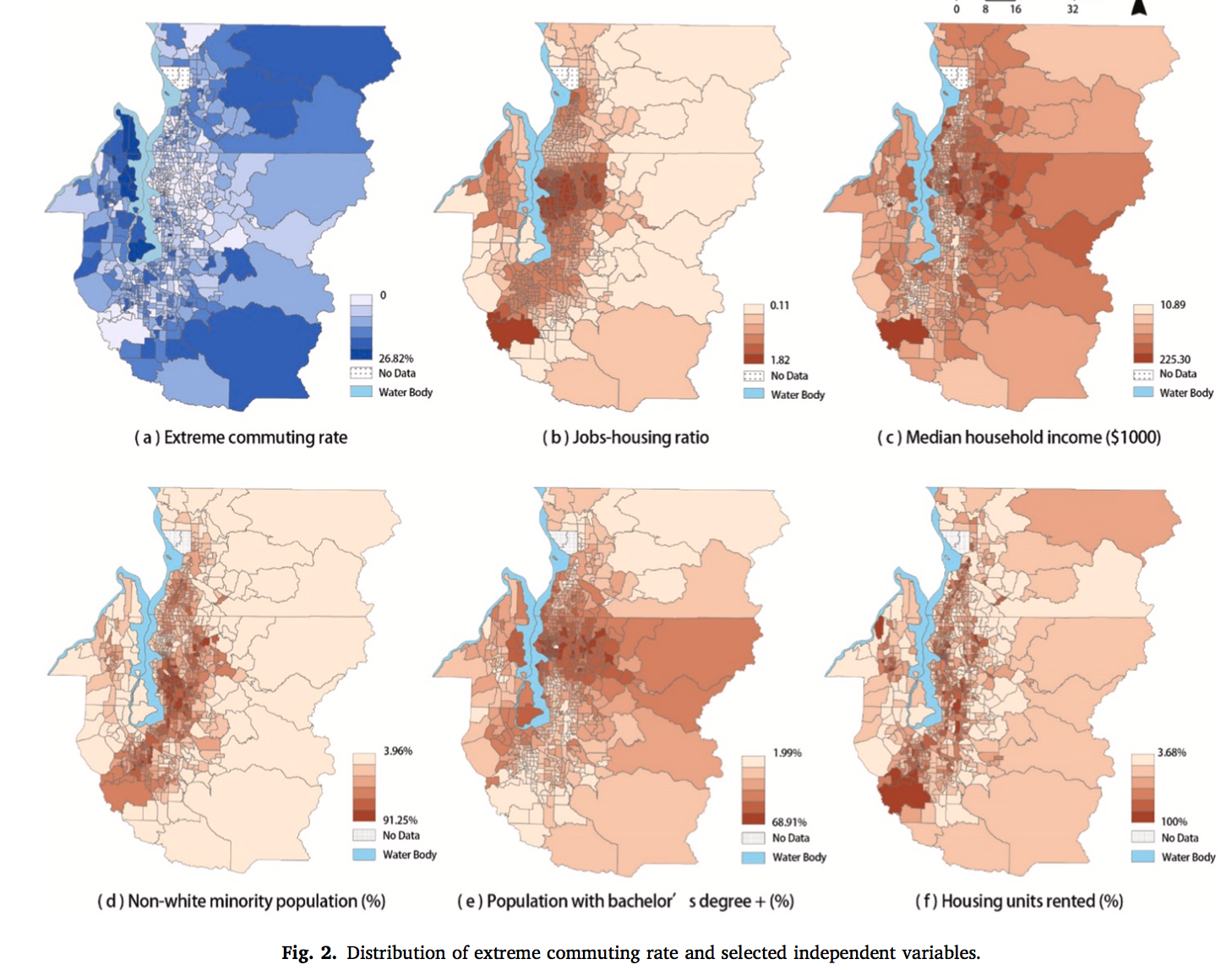
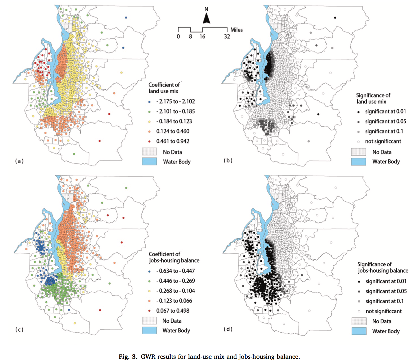
- Paper 4: Exploring extreme commuting and its relationship to land use and socioeconomics in the central Puget Sound
- Extreme commuters, who spend 90 min or more on one-way commuting, has been a rapidly growing group. A few studies explain extreme commuting from the socioeconomic and land-use perspectives. However, little research takes spatial variations into account, nor does it make a comparison of different transportation modes. This paper applies Geographically Weighted Regression (GWR) model and binary logistic model to explore extreme commuting and its relationship to land-use and socioeconomic attributes in the central Puget Sound. Data used include the Census Transportation Planning Package (CTPP) at the census tract level and the Puget Sound Travel Survey of the individual households. The results demonstrate both significant local variations of the effects of influencing factors and the differences in different transportation modes. These findings indicate that extreme commuting is not necessarily a constrained choice behavior due to socioeconomic disadvantages and that urban land-use planning is significant in explaining extreme commuting.
- Keywords: Extreme commuting; Land use; Socioeconomics; Spatial variation; Central Puget Sound